Now, first there are a couple of warnings. First, it's a desert folks. There is NO water. Bring lots and Drink it! Second, the best stuff in the park requires hiking...in the desert...where it is rocky...and there is NO water, or cell phone coverage either. So come prepared.
So after stopping at the visitor center and asking the nice folks there about the park, we decided to start by taking all of the short hikes. In the Needles there are four. I'll describe them in the order in which we did them.
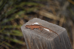
First was roadside ruin. It's probably the shortest and easiest of the hikes. The map said it was about .3 of a mile. But it seemed shorter. It's a good introduction to the area and you get a chance to see local plants (helpfully labeled in many cases) and some of the wildlife.
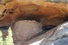
The trail takes you into a shallow wash and to a small ruin. The ruin is Puebloan and is a granary. It's also pretty much the only ruin that you can see without a long hike.
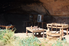
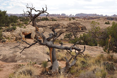
The second hike was Cave spring. The hike is .6 of a mile. Here you get to see an actual cowboy line camp. For you non-westerners, a line camp was a semi permanent camp or cabin that was used when the hands were out on the far edges of a ranch and needed a place to base camp while dealing with the cattle. In this case the line camp was placed under an overhang of rock near a small spring. From what I recall from the sign, the camp was in use from the 1890's until the 1960's.
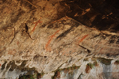
The next thing that you get to see is a series of petroglyphs. There was no information on them. But here they are.
The rest of the loop continues up and out of the canyon onto the slickrock and then back into the canyon.
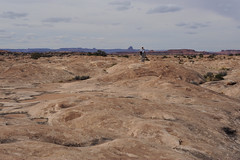
After lunch we took the longest of the 4 trails. Slickrock is a 2.4 mile loop. The recommended time is 2 hours. It will take that long. Hiking on the slickrock is like hiking on lava. It looks smooth from a distance but isn't. For those taking the hike, keep an eye out for Desert bighorn sheep as they are known to frequent his area. Although your chances to see one are slim at best.
This shot should give you an small idea of what the slickrock is like. And this is a smooth stretch :)
The final short trail is Pothole point. The trail is .6 of a mile. The best part of this isn't the views...
But the chance to see things like the Fairy shrimp.
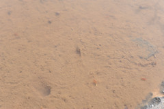
Fairy shrimp are a species that lives breeds and dies during the rainy season. They live in vernal ponds (or in this case potholes in the rock). It was pretty cool getting to see one and to see the other small red shrimp and the snails.
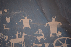
The last place that we stopped was Newspaper rock. Its not in the park but on BLM land on the road leading to the park. I'll just let the photo show you one small part.
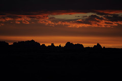
And on a final note, here is what the sunset looked like from our campsite.
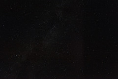
And a look at the stars as well :)
No comments:
Post a Comment